Voyaging through history in the Northwest Passage
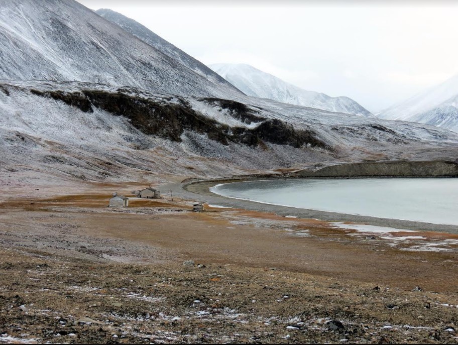
Looking back at our 2016 voyage Into the Northwest Passage, I find myself driven to juggling dates. Why? Well, because I love this image (left) of Dundas Harbour, which Sheena shot on Day Nine, and I think it deserves pride of place!
DAY NINE — Dundas Harbour
Under grey skies, we landed zodiacs on
the rocky beach in Dundas Harbour at ten in the morning. A scattering of people
headed off to a Thule archaeological site, but most made for the historical RCMP
post, long since abandoned. It faces southwest over Bernier Bay, so-called in
commemoration of a 1906 stopover by Joseph Bernier, who planted Canadian flags
throughout the Arctic.
At the RCMP site, several buildings
remain standing: a detachment building (two-person living quarters), a separate
house for Inuit hunters, two latrines, a couple of storehouses, and a dog
corral. The main residence, which is marked by considerable graffiti, contains
a few bottles and several books, the strangest of which is probably Dog Crusoe and His Master by Robert
Michael Ballantyne.
The RCMP erected these buildings in
1923 to establish Canadian sovereignty over the north. On a hill overlooking the
site stands a white-fenced cemetery containing two old graves marked by new
gravestones. Buried here were constables Victor Maisonneuve (1899-1926) and
William Robert Stephens (1902-1927). The first committed suicide, the second
died while hunting.
The HBC rented the outpost briefly in
the 1930s, and the RCMP maintained it until 1951, when it moved to the less
isolated Craig Harbour. The Canadian Coast Guard maintains the cemetery. In
1944, during the return voyage of the St. Roch through the Northwest Passage,
Henry Larsen called in here.
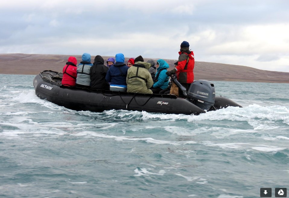
Afternoon took us into Croker Bay,
where more than sixty voyagers piled into seven zodiacs to take a close look at
Croker Glacier. A late afternoon fog lent an other-worldly air to the outing.
And then came the polar plunge, when the bravest (craziest?) among us tested
themselves by leaping or diving into the balmy, iceberg-cooled waters of Croker
Bay.
FLASHBACK TO DAY SEVEN – Etah
The magic moment came when fifteen
muskoxen, readily visible from Brother John Glacier, got spooked and ran hard
across the cliff face. Forty or fifty of us were hiking along near the glacier
front when this happened, and we all stood marvelling at the sight. We didn’t
know what had scared them, but we were glad they ran in the direction they did,
and not down the hill towards us. We resumed our trek along the glacier front,
and a couple of staffers hurried ahead to check the final stream, to see if we
could cross. They found a small river, recognized that crossing was impossible,
and launched us on our return journey, back the way we had come.
The day had begun with a 5:30 wake-up
call. Soon after 6:30, we were into the zodiacs and roaring down the
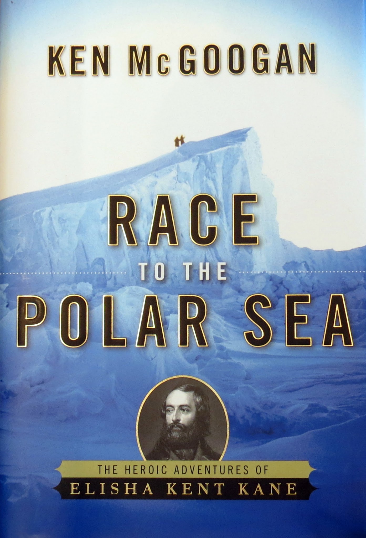
spectacular Foulke Fjord that leads to Etah. In the mid-1850s, when Elisha Kent
Kane got trapped in his wooden ship forty or fifty miles farther north, the
Inuit who lived here became his allies. They helped him and his men survive two
winters of dark, cold, scurvy, and amputations. (You can read all about it in Race to the Polar Sea.)
Today, Etah is essentially a hunting camp.
We had enjoyed a 40-minute zodiac ride down the 12-kilometre-long fjord,
admiring the cliffs and the wildlife – muskox, arctic hare, and gyre falcons. Later,
returning to the ship, many trekkers also spotted a few seals. Here at Etah, we
reached our “farthest north” for this voyage: 78 degrees, 22 minutes north. We
were 27 miles from Canada, directly across from Cape Isabella on Ellesmere
Island.
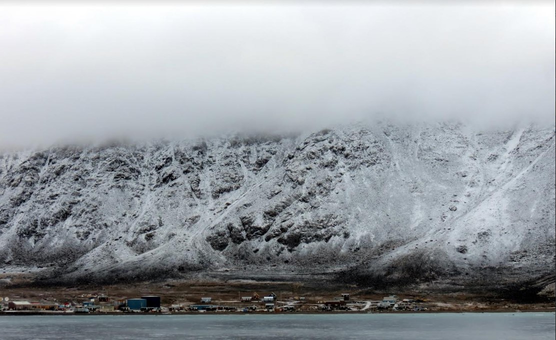
DAY EIGHT – Grise Fjord
A wave of laughter rolled through the
afternoon audience when, halfway through the docudrama Passage, Inuit statesman
Tagak Curley showed some impatience when teaching an actor playing explorer
John Rae how to build an igloo. The film, based on my book Fatal Passage, marked a move to Plan B.
We had intended to visit to Grise
Fjord on Ellesmere Island, Canada’s northernmost civilian settlement. In the
1950s, the Canadian government relocated three Inuit families here as an
assertion of sovereignty over these environs, and today, about 165 people,
mostly descendants of those displaced from northern Quebec, continue to reside
here.
Stormy weather prevented our landing,
and one adventurous staffer, musician Kevin Closs, took a dunking near shore
after helping to deliver some gifts to the community. We did manage to clear
Canadian customs by bringing aboard two officials, and then, after lunch,
shifted to the film in which Rae emerges as a singular champion of the Inuit
and Charles Dickens stands revealed as . . . . something else.
Towards the end of the film, our
fellow voyager Tagak Curley manages to elicit an apology from a
great-great-grandson of Dickens for the great author’s racist accusations.
Earlier in the day, Curley had given a talk on the evolution of Nunavut, which
encompasses 140,000 square miles of land. He traced the complex political
negotiations that settled the Inuit land claims agreement and then the
boundaries of the new territory.
That territory includes Grise Fjord,
which was named by explorer Otto Sverdrup. At 76 degrees 24 minutes north, the
village is 1544 kilometres from the North Pole. The original settlement, known
as the Old Village, was located nine kilometres away, on an exposed point that
can be reached only by water.The town moved when the RCMP arrived in the 1960s.
Susan Aglukark had written a special song focusing on the relocation. Before
resuming the voyage, Adventure Canada paid the community the agreed sum for the
presentation the people had prepared, and also set out a collection box for donations
from passengers.
