Beechey Island graves testify to the demise of the Franklin expedition
[Beechey Island is the most visited historical site in the Arctic — and with good reason. Last September, we got snow. In 2017, when we sail Out of the Northwest Passage, we will call in there once more.]
DAY TEN– Beechey
Island
Sixty or seventy beluga whales stole
the show at Beechey Island. We floated among them in zodiacs as they fed amidst
the small icebergs beneath the island’s stupendous cliff face. This was the
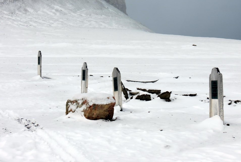
grand finale of the visit. We had landed near the graves and found the island
blanketed in a couple of inches of light snow. We climbed the slope on Beechey
to a series of four headstones, three of which mark the graves of sailors from
the Franklin expedition.
They died here in 1846, and after
burying them with due ceremony, Franklin and 125 men sailed south down Peel
Strait to meet their own fate. The fourth headstone marks the grave of a sailor
buried here in 1854, a man from Robert McClure’s ship, the Investigator. He had been
rescued from that vessel, which lay trapped in Mercy Bay on Banks Island, but
was already so sick that he did not survive.
After viewing the graves, first
discovered in 1850, passengers hiked slightly more than one kilometer along the
shore to check out Northumberland House. Searchers built it in 1852-53 from the
wreckage of an old whaling vessel. Several memorials and markers here are tangential.
But we saw the Franklin cenotaph, which stands over a marble slab sent here by
Lady Franklin to honour Joseph-Rene Bellot.
In 1853, Bellot had volunteered to
lead a small party north from Beechey Island to where British Captain Edward
Belcher was wintering. As Bellot proceeded, the ice edge broke off and left him
stranded, floating, with two men on an ice floe. Undaunted, he built a
snowhouse in which to shelter. Early in the morning, he stepped outside alone .
. . and was never seen again. He had slipped and disappeared into the frigid
waters. Later that day, the floe drifted to shore and Bellot’s traumatized companions
jumped off to safety.
In front of the slab at Beechey,
rusted tin cans from the Franklin expedition form a cross on the ground. At the
rear of the cenotaph, we saw a wooden two-by-four etched with lettering: J.E.
Bernier / 1906. Canadian Joseph Bernier visited here during his multi-year
expedition to assert Canadian sovereignty over the entire Arctic archipelago.
Then came the belugas! We had climbed
into zodiacs anticipating a short cruise among icebergs scattered along the
cliff face. Suddenly, there they were, cavorting all around us. Veteran voyager David Freeze was driven to declare that he had never seen anything like it.
DAY TWELVE — Fort
Ross
Early in the morning, having sailed eastward through Bellot Strait, the Ocean Endeavour reached Prince Regent Inlet.
Starting at nine in the morning, we went ashore in zodiacs to visit Fort Ross.
The site, so named by the Hudson’s Bay Company, comprises two weather-beaten
wooden buildings. Erected in 1937, this was the HBC’s last-built fur-trade
post. It proved so hard to reach that the Company shut it down in 1948, after
two HBC men received no communications or supplies for three years.
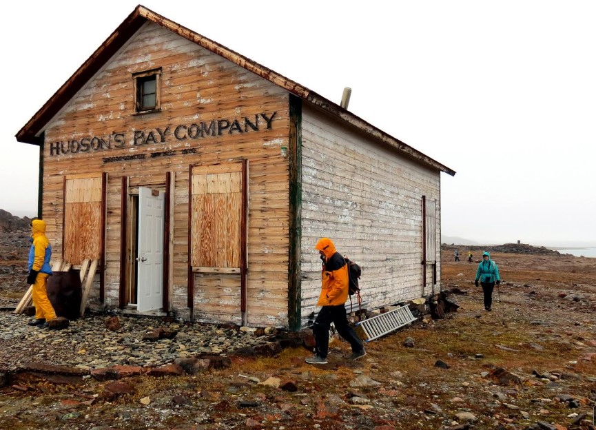
Both HBC buildings have seen better
days, but one of them, originally a storehouse, has been maintained. Inside we
found the old familiar stove, table, chairs, and bunk beds. Inuit hunters from
Taloyoak frequently shelter here. The second building, originally the manager’s
house, is about thirty metres north. Polar bears have repeatedly ransacked the
place, leaving broken windows, peeling wallpaper, wrecked armchairs, and
scratches on the ceiling.
The HBC named this site in honour of John
and James Clark Ross. Starting in 1829, they spent four winters trapped by the
ice of Prince Regent Inlet. The two Rosses and their men hauled whaleboats past
this location from the southern reaches of the Inlet. In August 1833, they
managed to sail the boats out into Lancaster Sound and flag down a passing
whaler. During the second winter, in 1831, James Clark Ross had sledged
overland and marked the site of the Magnetic North Pole on the west coast of
Boothia Peninsula.
Besides the two buildings, Fort Ross
boasts several sites of interest. The first, to the southwest of the
storehouse, is a series of stone-covered graves which contain the remains of several
Inuit who worked with the HBC. The second is a sturdy memorial slab erected in
1979 by the descendants of Francis Leopold McClintock. A third feature of the
site is McClintock’s Cairn, which stands at the highest point on a rocky ridge
behind Fort Ross.
In the winter of 1858-’59, anyone
standing beside that cairn would have been able to see the Fox, locked in the ice and battened down for the winter; and also a
magnetic observatory roughly 200 metres from the ship, “built of ice sawed into
blocks,” McClintock wrote, “there not being any suitable snow.” From here,
travelling by dogsled, McClintock visited the west coast of King William
Island, as specified by John Rae, and found the Victory Point Record left by
the Franklin expedition.
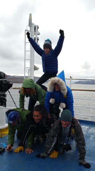
The Ocean Endeavour sailed west from Fort Ross through Bellot Strait.
At around 3:40 p.m. we passed Zenith Point on Boothia Peninsula, the
northernmost point on the North American mainland. Most voyagers were up on
deck as we travelled through the strait, which is 23 miles
long, just over 2400 feet wide, and 35 metres deep in the middle. A mad sextet marked the occasion by building a human cairn. Maybe you had to be there.
